Himalayan Mountains
Geography of India
[ Geography of India ]
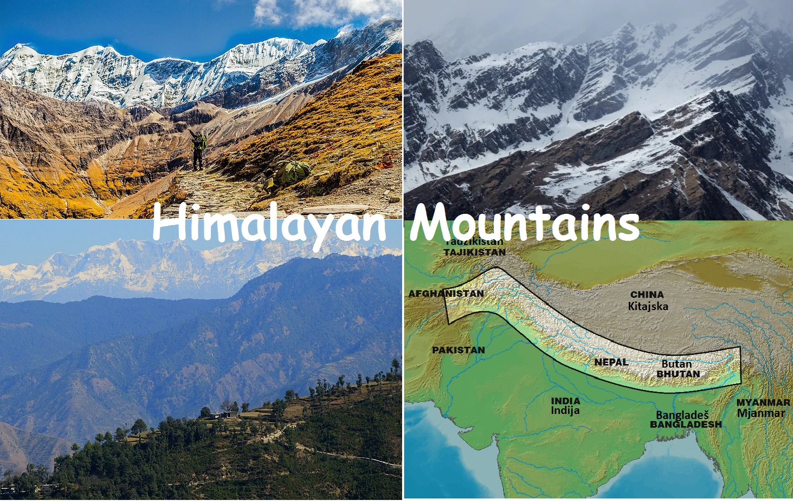
The Himalayas are the natural northern boundary of the Republic of India. The entire Himalayan Mountains are classified into – 1. the Western Himalayas, 2. the Central Himalayas and 3. the Eastern Himalayas.
Himalayan Mountains
The
word Himalayas means ‘abode of snow or habitat of snow'. Geologists believe
that the Himalayan Mountains were formed due to the shrinking action of the
Tethys Sea in the last phase of the geological history of the earth. The
Himalayas are the natural northern boundary of the Republic of India. The
Himalayas are young mountains because they have striking contrast in their
relief such as steep slopes and pointed peaks. The mountain ranges appear in
several parallel folds. The entire Himalayan Mountains are classified into –
1.
the Western Himalayas,
2.
the Central Himalayas and
3.
the Eastern Himalayas.
1.
The Western Himalayas:
The
Western Himalayas are a lofty range of mountains that lie in territories of
three nations, Afghanistan, India and China. Therefore, they are called the
Trans Himalayas. The Karakoram Range is an important range in the Western
Himalayas which extends eastwards from the Pamirknot to India’s frontier with
Afghanistan and extends further down to south-east of Kashmir. The Zaskar range
and the Ladakh range are the other two important mountain ranges that lie in
the Western Himalayas. The Ladakh range and the Zaskar range are the parallel
ranges that lie to the south of the Karakoram range. The Ladakh plateau is the
extension of the Ladakh range of mountain that lies in the north western
regions of Kashmir. The Ladakh plateau is the highest plateau in India. The
Siachin glacier and the Baltoro glaciers are the two important glaciers located
in the Western Himalayas.
2.
The Central Himalayas:
The
Central Himalayas stretches from Kashmir in the westtotheArunachal Pradesh in
the east. The west-east distance of the Central Himalayas is about 2500 km. The
width of the Central Himalayas varies from 400 km in the western regions, to
about 150 km in the eastern regions. The region Central Himalayas has numerous
steep slopes and pointed peaks. The mountain ranges in this region appear in
parallel foldings and the height of the eastern half is greater than the height
of the western half. The Himadri, the Himachal and the Siwaliks are the three
subdivisions of the Central Himalayas.
(a) Himadri Range:
The Himadris range are the northern ranges of the Central Himalayas. It looks
like an arc extending from the Indus valley to the Brahmaputra River. Himadri
is the abode of several mountain peaks in the world. The highest peak in the
world, the Mount Everest (8848mts) is found in the Himadri range. Important
other summits found in the Himadri range are the Kanchan Junga (8598mts), the
Nanga Parhhat (8126mts), Dhaulagiri (8167mts) and Nanda Devi (7817mts). The
Himadri consists of several glaciers that have become the source for many
river; Gangotri and Yamunotri are two important glaciers. The Himadri range
consists of several passes - Zojila Pass in Kashmir, Sipkila Pass in Himachal
Pradesh and Nathula and Jelapla Pass in Sikkim are the important passes.
(b) The Himachal Range:
The Himachal range of the Central Himalayas is a parallel range that lies
between the Himadri in the north and the Siwalik in the south. The average
width of the range is about 80km. The Himachal range is the middle range of the
Central Himalayas having an average width of 80km. The height of the range
varies from 3700 - 4500 mts. It has a rugged topography consisting of spurs and
dissected uplands. The Himachal has several ranges of mountains and numerous
valleys between the ranges. The Pirpanjal and the Dhauladar range are the two
important ranges found in the Himachal which has numerous valleys.
The
Kashmir valley, the Khangra valley, the Kulu valley are the important valleys.
Thousands of tourists flock to Himachal regions to spend their holidays in hill
stations every year. Pahelgam, Gulmarg, Mussourie, Simla, Srinagar and
Nai.tital are the important hill resorts. The Himachal is also a region of
religious importance. Amarnath Temple, Kedarnath Temple, Badrinath Temple and
Vaishnavi Devi Temple are some of the Hindu religious centers found in the
Himachal range.
(c) The Siwalik regions:
The Siwalik range is the lowest range of the Himalayas. The range consists
numerous hills called the foothills of the Himalayas. The Siwalik range is a
discontinuous range made up of soft and muddy rocks. The region has some
longitudinal valleys. Dehradun is one such valley. The Tarai plain is located
in the southern part of this range. The Tarai plain is the result of fine silt
brought by perennial rivers that originated in the upper and middle Himalayan
ranges. Thick forests and marshy lands are found in the Terai plain.
3.
The Eastern Himalayas:
The
Eastern Himalayas is also called Purvachal Hills. The Purvachal hills consist
of the Patkai Bum hills and the Naga hills in the north and the Mizo hills in
the south. Purvachal hills have a medium height, and hills appear in the border
between India and Bangladesh. In the border regions the Eastern Himalayas has
three important ranges, the Jaintia, the Khasi and Garo hills. These hills act
as climatic barrier to the Bay of Bengal branch of the south-west monsoon.
Geography of India : Tag: Geography of India : Geography of India - Himalayan Mountains


