Physiography of India
[ Geography of India ]
To understand the physiographic divisions of India. To know the structure and formation of Himalayas, Great plains and peninsular plateau, coastal plains and Islands. To learn about the significance of each physiographic divisions of India,
Physiography of India
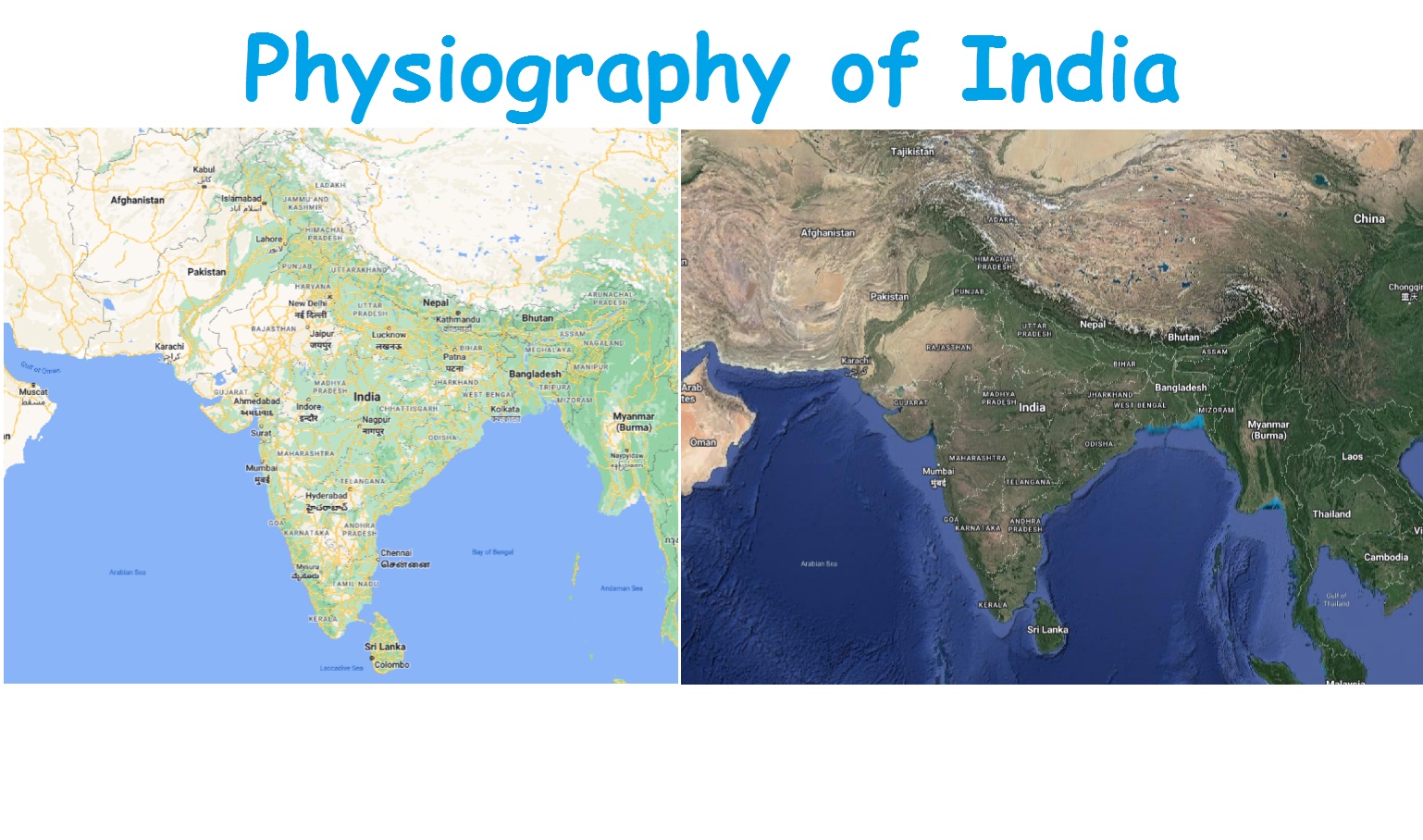
Physiography means the description of the physical relief features of a country. India has a well defined physiographical entity. The present physiography of India have evolved in the course of a long chequered geological history. The remains of flora and fauna preserved in different layers of the rocks help to determine their age. To understand the varied physical features of India, let us have a glance on geological history of India.
Geologists
believe that it was the shrinking action of the Tethys Sea that created the
Himalayan Mountains. The Himalayas gave birth to agents of gradation such as
the rivers and the glaciers. The Himalayan Mountains extend from Pamirknot in
the north-west to Kasi Jaintia Hills in the east. The lofty mountains acted as
gigantic physical boundary and prevented invaders to enter India during the
Medieval Period. The glaciers such as Gangotri and Yamunotri have become
religiously significant for they are the sources of the holy rivers, the Ganga
and the Yamuna. The pilgrim centers such as Kedarnath and Badrinath, and hill
resorts such as Gulmarg and Nainital are also located in the Himalayas. The
lower ranges of the Himalayas have valleys such as Dehradun.
The
agents of gradation such as rivers and glaciers carried huge amount of silt and
deposited into the Tethys Sea. This erosion process led to the formation of
Northern Great Plain. The vast area of the Great Plains has a great
agricultural significance. The plains support the cultivation of rice and wheat
in large quantities and hence they are called the granary of our country. The
Himalayas, the Northern Great Plains, the Peninsular Plateau and the coastal
lines became important political divisions of India. The Himalayas became not
only active climatic barriers but also the birth place for hundreds of rivers.
The river basins of these rivers are responsible for the growth of
civilizations.
The
Western Ghats and the Eastern Ghats the twin system of mountains, that lie in
the Peninsular India are part of Gondwana landmass. The Western Ghats is famous
for its thick lush evergreen forests. The Eastern Ghats is a series of hills
located mainly in the south-eastern regions of India. India's coastline is the
largest of its kind in the world. The coastal plain that extends from the Rann
of Kutch in the west to the West Bengal in the east passes through Kanyakumari
in the south. The fertile deltaic soil found in the deltas created by the
rivers has made the coastal plain an area of intense agricultural activity. The
Andaman and Nicobar Islands in the Bay of Bengal and the Lakshadweep Islands in
the Arabian Sea are the two main Island groups in India.
Major physiographic divisions
The
land of India is characterised by a great diversity in its physical features.
Based on the structure, India may be divided into five physiographical units.
They are,
- The Himalayan
Mountains
- The Northern Great
Plains
- The Peninsular
Plateau
- The Coastal Plains
- The Islands
I. The Himalayan Mountains
The
Himalayas in the Northern India, consists of series of parallel mountain ranges
with bold relief and complex topography.
The
Himalayas are further subdivided into 3 parts. They are,
-
The Western Himalayas
-
The Central Himalayas
-
The Eastern Himalayas
II. The Northern Great Plains
The
great plains lie between the mountains of the north and the peninsular plateau
of the south. It extends over a length of 2400 km. It has a width of 2400 km in
Bihar to 500 km in Punjab.
The
Great plains is a flat low lying land made up of Alluvium – the fine silt
brought down by the rivers. The plain in the past was a huge depression where
the rivers have deposited layers of alluvial sediments.
The
three big rivers draining this region are Indus, Ganga and Brahmaputra. They
collect their water from Himalayan glaciers. The rivers cross the lofty
Himalayan range through narrow deep gorges or deep canyons and enter the
plains. Geologists consider that these three rivers were older than the
Himalayas that as the Himalayas lifted themselves up, the rivers have eroded
their valleys. The northern plains are the youngest as they are made up of
sediments laid down by the denudation of the Himalayas.
The
surface relief of great plains are classified into four types based on the
structure of soil.
i.
The Bhabar lies all along the foot hills of siwalik. It is a pebble – studded zone
of porous beds. It is a narrow belt with 8 to 16 kms 2
ii.
The Terai belt is marked by excessive dampness with the growth of thick forest
and a variety of wild life.
ii.
The Bhangar is the older alluvium of the plain.
iv.
The Khadar is the new alluvium of the plain. They form a continuous belt of
alluvium. These plains may be subdivided into the following basins.
•
The Indus basin
•
The Ganga basin
•
The Brahmaputra basin
•
The Ganga - Brahmaputra Delta
i) The Indus basin
The
Indus river has its source in the Kailash range to the north of Manasarovar
lake. It was the cradle of ancient Indus valley civilization. It flows in a
north westerly direction. It takes a turn to the south through Ladakh range I
enters Pakistan through Kashmir. It receives water Women Ravi, Beas and Sutlej.
All the rivers except Sutlej rise in the Himalayas. The Sutlej originates in
the Manasarovar region in Tibet and enter the plain through deep narrow gorges.
The Indus then flows across the desert plains of Sind and drains into the
Arabian sea.
ii) The Ganga basin
iii) Brahmaputra basin
The
river Brahmaputra originates from a glacier, south east of manasarovar region.
It flows through deep gorges and enters into the lowlands of Assam. The valley
slopes from east to west. It is frequently flooded and takes away a heavy toll
of life during the monsoon. It joins the lower course of Ganga and flows into
Bay of Bengal.
iv. The Ganga
Brahmaputra Delta
It
is the largest and fastest growing delta of the world. The Brahmaputra after
joining the Ganga splits into numerous distributaries. Due to the gentle slope,
the river becomes sluggish, and enormous amount of silt is deposited. The lower
part of delta becomes marshy where fresh water and sea water gets mingled owing
to high and low tides.
Significance of Plains
:
1.
These vast plains are called granaries of our country, growing rice and wheat
in large quantities.
2.
The climatic conditions favour cultivation of a wide variety of crops namely
cotton, Jute, Sugarcane, pulses and oilseeds.
3.
Numerous perennial rivers enable irrigation in areas of erratic rainfall.
4.
Dams have been constructed across these rivers which help in generating hydro
electric power.
5.
This in turn leads to the development of industries.
6.
The flat nature of the plains facilitate construction of roads and railway lines.
7.
A large number of towns have come up in the plains as industrial, pilgrimage,
commercial and educational centres.
8.
All these factors have favoured a high concentration of population in the great
plains.
III. The Peninsular Plateau .
The
peninsular plateau lies to the south of the Great plains. It is triangular in
shape with its broad base in the north. The plateau features a series of
mountain ranges that rise abruptly from the adjoining plains. It has a senile
topography dominated by erosional surface and broken by striking ridges and trough
valleys. When the Gondwana land was subjected to earth movements there occurred
a number of fissures in the northwestern parts. Through the fissures lava
flowed out and deposited on the peninsular plateau. Thus, thi lava plateau
underwent several geological changes.
The
peninsular plateau is subdivided into 2 parts. They are :
1.
The Central Highlands
2.
The Deccan Plateau.
IV. The Peninsular Plateau .
The
peninsular plateau lies to the south of the Great plains. It is triangular in
shape with its broad base in the north. The plateau features a series of
mountain ranges that rise abruptly from the adjoining plains. It has a senile
topography dominated by erosional surface and broken by striking ridges and trough
valleys. When the Gondwana land was subjected to earth movements there occurred
a number of fissures in the northwestern parts. Through the fissures lava
flowed out and deposited on the peninsular plateau. Thus, thi lava plateau
underwent several geological changes.
The
peninsular plateau is subdivided into 2 parts. They are :
1.
The Central Highlands
2.
The Deccan Plateau.
V. The Islands
Besides
the mainland, Indian territory also extends into the Arabian and the Bay of
Bengal in the form of the Lakshadweeps and the Andaman and Nicobar Islands
respectively. The Lakshadweeps are small Coral Islands. The Andamans and
Nicobars are cluster of Islands stretches almost in a line. There are as many
as 200 islands in the Andamans Group extending for 350 kms. There are 19
islands in the Nicobar group. Some of the islands are of volcanic origin.
‘Barren island' is an active volcano. This is the only active volcano of India.
The
physical features of India, though different from each other, they are
complementary to one another. It influences the climatic conditions and favours
man's varied activities.
Geography of India : Tag: Geography of India : - Physiography of India


